
By Joey Flechas, Sarah Blaskey and David Ovalle
Miami Herald
MIAMI – Hurricane Dorian weakened into a Category 4 on Monday, but remained a ferocious major hurricane pounding the Bahamas with winds of 155 miles per hour and leaving Floridians nervously awaiting its expected turn northward – away from the state's coast.
The killer system, already blamed for at least one death in the Bahamas, was centered late Monday morning about 110 milers off the coast of West Palm Beach. It was drifting westward at only 1 mile per hour, although it had ticked northward a bit as of the 11 a.m. advisory from the National Hurricane Center
"The hurricane will then move dangerously close to the Florida east coast late tonight through Wednesday evening," the National Hurricane Center said in its advisory.
Computer models continued to show the storm turning north before making landfall in Florida, but the proximity to the coast was still concerning. And while the storm might weaken a bit, the scope of its winds may affect a larger swath, according to the National Hurricane Center.
"It is still possible for the hurricane to deviate from this forecast, and move very near or over the coast," the hurricane center wrote. "Users are reminded not to focus on the exact forecast track. In addition, Dorian's wind field is predicted to expand, which would bring hurricane-force winds closer to the east coast of Florida even if the track does change."
Much of Florida's coast remained under a hurricane or tropical storm watch. Some tropical-storm force are expected to hit Broward County by Monday night. There are no watches or warnings in Miami-Dade.
Instead of Labor Day barbecues, residents across Florida hunkered down in their shuttered homes, already stocked up on gas, water and snacks, glued to television news stations.
Tolls were suspended. Palm Beach International Airport closed on Monday, and flights were due to be suspended at Fort Lauderdale-Hollywood International Airport at noon.
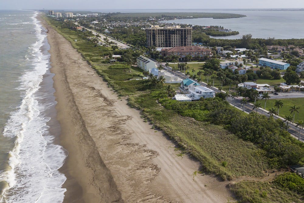
At Sexton Plaza, a popular beach-side hub in Vero Beach, gawkers took selfies in front of the increasingly choppy surf. A blustery wind blew salt and sand as a police officer, Jennifer Brumley, urged them to evacuate east of U.S. Highway 1.
"People have been talking about this turn, but it hasn't turned yet," Brumley said. "It's still heading west. It could turn. We want it to turn, but what if it doesn't?"
Gusts of tropical-storm force winds were starting. One gust of 47 miles per hour was reported at the Juno Beach Pier, according to the National Weather Service.
"It's going north," said Ann Huff, a 30-year Juno Beach resident who huddled under a sea grape tree near the beach with her husband and French Bulldog as a rain squall passed through. "When I was pregnant, I knew I was going to have a boy. I have the same feeling here. It's going north."
Authorities weren't taking any chances.
Residents of 72 nursing homes or assisted living facilities along Florida's coast have been evacuated, and some hospitals from New Smyrna Beach to Port St. Lucie have begun evacuating patients.
Gov. Rick DeSantis, at a morning press conference, implored healthcare facility administrators to update the state on how their generators are working and their evacuation status. "If you have a generator, and something's wrong with the generator, you need to tell us that," he said.
Over in the Bahamas, the scope of the historic hurricane's wrath was clear.
Residents in the capital of Nassau were trying to escape rising water in the midst of an island-wide blackout.
On Abaco, at least one child, a 7-year-old boy, was reported drowned, with his sister missing, according to Bahamian press reports. Donald Rolle, the administrator for South Abaco, described the scene on North Abaco as "sheer devastation. "Pray for us," he pleaded.
After pounding the Abacos and leaving a trail of snapped trees, flipped-over cars and missing rooftops in the northern Bahamas, Dorian moved over to low-lying Grand Bahama, where it stalled for hours. The Bahamian press reported that the airport at Grand Bahama Island was under five feet of water.
Islanders reported tidal surges of up to 23 feet. Wind gusts were clocking in at up to a staggering 200 milers per hour. "These hazards will continue over Grand Bahama Island during most of the day, causing extreme destruction on the island," the National Hurricane Center said in a 10 a.m. advisory.


