
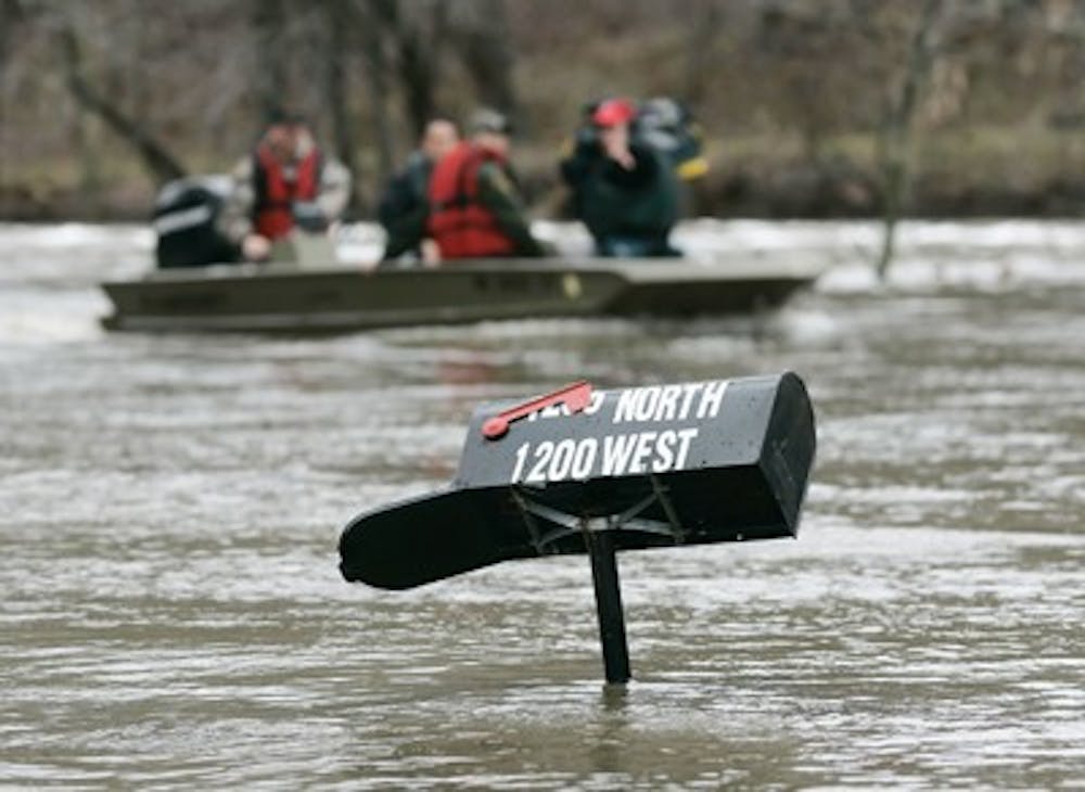
REMINGTON, Ind. – Storms that dropped more than 5 inches of rain on parts of Indiana amid record warmth pushed rivers and streams over their banks, killing at least one person and threatening to overwhelm a dam on the Tippecanoe River.\nA man was swept into floodwaters in Remington and drowned Tuesday morning as he was trying to get out of his house after Carpenter Creek flooded, said Karen Wilson, Jasper County Emergency Management director. Remington is about 90 miles northwest of Indianapolis.\n“The waters were moving so rapidly and so deep that he just went under and didn’t come back up,” she said.\nShe said up to 150 people were evacuated around Remington and up to 30 homes were affected by water that reached waist-high levels in some places. Evacuees were sheltered in local churches.\nIn nearby White County, where the National Weather Service had issued a flood warning, county emergency management director Gordon Cochran said boats had been called out to assist in evacuating hundreds of people in Monticello, Blue Water Beach and Diamond Point, which are all about 80 miles northwest of Indianapolis.\nCarroll County Emergency Management director Dave McDowell said 200,300 homes may possibly be flooded but that many are unoccupied summer residences.\nThe weather service reported near-record flooding at the Norway and Oakdale dams just north of Monticello, a city of 5,400 people about 30 miles north of Lafayette.\nMcDowell said officials are recommending that all residents south of the Oakdale Dam leave their homes.\nThe weather service said that neither dam was expected to fail but urged residents to closely monitor the situation along the Tippecanoe River, which was forecast to rise steadily into the afternoon. White County Sheriff John Roberts confirmed that the dams are holding, although water levels were high.\n“The water, either from wind or the flood, is coming over the top of the dam, but it’s minimal,” Roberts said.\nMaster Trooper Bill Brooks said the speed of the Tippecanoe River jumped to nearly 27,000 cubic feet per second at around 9 a.m. from nearly 23,000 cubic feet per second at about 7:15 a.m.\nU.S. 24 was closed for more than 20 miles between Reynolds and Interstate 65, Brooks said. The Indiana Department of Transportation said several other highways in northwestern Indiana also will be closed until floodwaters recede.\nSome roads had washed out in White County, including Indiana 16 east of Monon, which is closed.\nPaul Dyke, youth minister at First Christian Church in Remington, said about 150 evacuees were taking shelter at the church. The American Red Cross set up shelters in Lafayette, Delphi and smaller towns along the flood path.\nLafayette city officials were preparing in case the rain continues to raise the level of the Wabash River. At noon, the weather service issued a flood warning along the Wabash from Lafayette to Terre Haute.\nThe thunderstorms that dumped the heavy rains were accompanied by record warmth across much of the eastern half of the nation that pushed Monday’s high in Indianapolis to 68, breaking the old record of 64 set in 1907.\nNear-record highs were expected again Tuesday across much of Indiana, said Joseph Nield, a meteorologist with the weather service’s Indianapolis bureau.\n“We’ve been kind of sandwiched between high pressure to the east and strong low pressure to the west that’s brought southerly and southwesterly winds,” he said.\nNield said a cold front will pass across the state overnight, bringing cooler air, although even those readings, in the upper 40s, will be unseasonably warm. January’s average highs are in the middle 30s, he said.
Man killed, hundreds forced to flee in wake of Tuesday’s flood
Get stories like this in your inbox
Subscribe


