
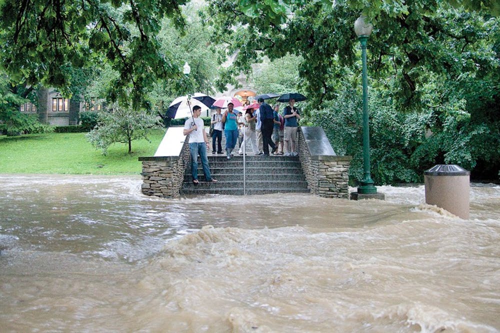
Officials now believe the flooding last week that gushed through campus caused an estimated $1 million to $1.5 million in damage to IU facilities, said Larry Stephens, director of the IU Office of Risk Management. Experts say the varied types and poor planning of development likely contributed to the severity of the flooding.\nThe flooding, which submerged much of Central Indiana last weekend, was triggered by extreme rain events that fell on ground already saturated by water, said Sally Letsinger, a research hydrogeologist for the Indiana Geological Survey. In such circumstances, excess water from heavy rains run off the surface of the ground instead of in the sub-surface, which in turn creates flooding.\nImproper and excessive development was also a likely cause of flooding, Letsinger said. Impervious ground surface material like asphalt and concrete severely hinder normal drainage, she said.\nOne problem, said Suzie Delay, an engineering manager of the Indiana Department of Natural Resources, is that no single, all-encompassing government body regulates development with the purpose of considering all the waterways of a community or a region. Many levees are privately owned and their construction does not take into account the impact of holding back water on a broader scale.\nDelay said that the state deals only with regulating development in floodways. As defined by the Federal Emergency Management Agency, a floodway is where the water is likely to be the deepest and fastest for most waterways. Anyone looking to build in a floodway needs to seek a permit from their office.\nSurface water drainages such as the Jordan River and man-made culverts in Bloomington were overwhelmed by the volume of rain on June 4. Culverts, conduits used to enclose and reroute a flowing body of water, can only take so much water, Letsinger said.\n“There should be policy discussions on how much development should be allowed and in what areas,” she said.\nThe apartment of Bloomington resident Rick Graves was inundated by last week’s floods. One of the two ditches flanking Mitchell Street had recently been paved over, which he believes contributed to flooding in the area.\nMonroe and many surrounding counties have experienced massive flooding in recent days. Many rural and suburban areas in the region were heavily impacted by the flooding on June 7. There were reports of levees having broken or eroded away.\nBill Miller, who lives just outside Terre Haute near a privately owned levee on Jordan Creek, said that although it did not break, the levee overflowed spilling water into the residential area. Fifty truckloads of white rock were delivered on Monday to divert the flow, but it is just a temporary repair.\nDespite the danger of flooding, people like to live by water, said Delay. Many people who live near levees have the misunderstanding that all levees are alike. Some are agricultural levees that are meant only to protect farm fields and are not designed to take care of flooding of this magnitude. Some are actually designed to overflow in order to prevent devastating floods in more populated areas.\nIf you live near a levee, it is important to know what type of levee it is and what it was designed to do.\n“It’s like expecting your bicycle to go 40mph when it wasn’t designed to do that,” said Delay.\nShe urged people to find flood maps of their area provided by FEMA to better assess the risk of flooding.
DNR says limited authority impeded drainage planning
Get stories like this in your inbox
Subscribe


